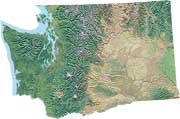
Eastern Washington
shaded relief map
Color composite map showing shaded relief and land cover of Eastern Washington
including names of ridges, coulees, scablands and other natural features.
Eastern Washington map of wildlife
areas, refuges and parks
Index map to major wildlife areas based on the shaded relief map of Washington
State and linking to descriptive Web pages and site maps. Includes a collection
of links to related travel and recreation maps.
1936 map of Cle Elum Recreation
Area
Historic illustrative map showing the area east of the divide of the Cascade
Range, north of Snoqualmie Pass and east to Cle Elum. High quality cartography.
Bear sighting in eastern Washington
Map displaying a Japanese bear on the map of Washington.
Central Cascades Geotourism Map - National Geographic
Points of interest in around the Central Cascade Mountains of Washington and Oregon.
Wenatchee - Leavenworth Trail Map - Adventure Maps
Order map of trails for mountain biking, horseback riding and cross-country skiing.
The human footprint of the Western United States
Map depicting the extent of land conversion and intensity of use across the west, indicating the huge changes affecting most of Eastern Washington and potential need for natural connectivity in the region.
Eastern Washington highway maps (Adobe Acrobat)
These high-quality road maps are available free from Washington State
Department of Transportation:
- Pasayten Wilderness, Okanogan Valley, Lake Chelan
- Colville Indian Reservation, Lake Roosevelt
- Pend
Oreille, Selkirk Mountains
- Snoqualmie Pass to Cle Elum
- Mid-Columbia from Ellensburg to Bridgeport
- Columbian Basin, Moses Lake north to Lake Roosevelt
- Spokane
and the Palouse
- Yakama Indian Reservation and the Klickitat
- Yakima to Richland and south to the Columbia River
- Tri-Cities, Walla Walla and the Snake River
- Blue Mountains, Asotin area
Major Cities
- Spokane, Washington
- Tri-Cities: Richland, Kennewick and Pasco
- Wenatchee and East Wenatchee
- Yakima, Washington
WSDOT highway map of Washington State
Inland Northwest
maps
Collection of maps covering Eastern Washington and displaying geologic,
historic, public lands and recreation information.
Eastern
Washington maps - Librarian's Index
Query from a librarian-reviewed Web directory of sites providing various
Eastern Washington maps.

Palouse Artwork courtesy of Barb Ullman

