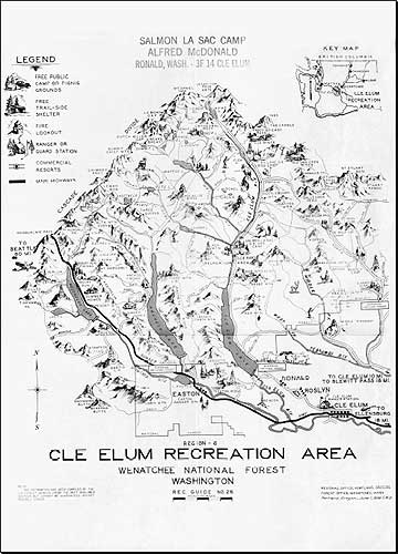
1936 Cle Elum Recreation Area map
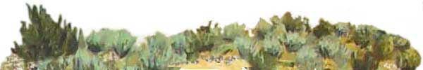
Eastern Washington
 (Download
PDF file below) (Download
PDF file below)
Classic 1936 illustrated forest service map of the Cle Elum Recreation
Area, part of the Wenatchee National Forest covering the eastern slope
of the cascade range in Washington State. The map area extends from
Snoqualmie Pass east to Cle Elum and north to La Bohn Gap, Mount Daniel,
Deception Pass, Mt. Stuart and the Stuart Range. At the center of the
map is Salmon La Sac and Fish Lake.
This illustrated map was created by the U.S. Forest Service
with perspective relief, drawings of lookouts, mountain sheep and goats,
mountain climbers, fishermen, and vacation cabins and other features,
and hand-lettered. Cartographer initials are C.W.D. apparently based
at the Forest Service Regional Office in Portland, Oregon.
The map was used in the 1930's by Elsie Riley, as a young
girl on a horse pack trip with her aunts Hope and Helen. She had the
time of her life on this trip and kept a scrap album of pictures, drawings,
pressed flowers, and this map.
The map is available in Acrobat PDF format: 1936
Cle Elum Recreation Area map.
» Eastern Washington maps collection
» Eastern Washington animals and plants
» Eastern Washington wildife
areas, refuges and parks
» Cle
Elum campgrounds
» Cle
Elum tourism map
|